October 27-Nov. 13th, 2019
San Diego to Cabo San Lucas to Isla Isabel to Puerto Vallarta
For the trip
from San Diego to Puerto Vallarta, we were fortunate to have two of Kevin’s
former co-workers, Demian and Todd, join us. They have both taken multiple ASA (American
Sailing Association) courses and enjoy watching/reading sailing stories—and,
who knows, may own and sail on their own boats one day. The guys arrived on
Saturday, Oct. 26th.
We were sooo
ready to untie the dock lines to head South, but despite our excitement, this
was a stressful time, especially for Kevin, as he hit one roadblock after
another trying to get our paperwork in order (stay tuned for K’s own blog post
about the nightmare of dealing with the three TIPS and lack of a Zarpe on our
vessel) and waiting on our new sails, which we had ordered from Turkey in July
and did not receive until October 24th, just three days before our departure.
Kevin and I raised
our new sails (minus our new spinnaker sail, which was shipped in a different
box), crossing our fingers that there wouldn’t be a problem with them since we
had no time to do a shake-down sail with them before we left for Mexico.
On Oct. 27th,
we left San Diego harbor around 6:00 a.m. As we made our way out of the miles’
long channel into the open ocean, we had a cruise ship pass us (see the pics of
the Disney Cruiseline: the same ship that parked behind us in Cabo San Lucas
almost a week later, most likely making its second or third trip for the week),
and lots of fishing vessels both entering and leaving in the dark with us.
 |
| Passing Disney cruise line on our way out of San Diego |
 |
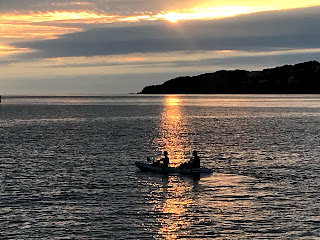
| Our first sunset at sea, about an hour from Ensenada. |
One of our
best memories happened about 40 minutes
into our motoring: Demian grabbed the helm, and we saw what looked like a
fishing vessel on our starboard side (right side) of the channel…we were unsure
of what he was doing—realizing a little late that he was headed into the
channel from the southeast and was actually towing another vessel. Well, Demian
kind of weaved from right to left, not knowing what his intention was. The
captain of this vessel then threw open the door to his flybridge and started
cussing at us—bellowing, actually—about right of ways, etc. He looked like a
raving lunatic….and we only caught the occasional, “. . .you fucking asshole .
. . .” for his three minute diatribe. All four of us looked at each other,
laughed, and Demian calmly said, “Well, I know I will live longer than that
dude.” All in all, we thought we were off to a good start.
We spent the
day settling into our routines—Demian behind his Ipad watching some downloaded
movie, Todd behind his book (a favorite of mine, East of Eden), Kevin
tinkering with something boat-related, and me, either behind Herman Melville’s Typee
(already thinking of the South Pacific!) or my recipe books as I planned and
cooked all of our meals.
Our first
day only lasted about 11 hours, as we pulled into Ensenada around 7:00 p.m. We
grabbed some fish tacos and Tacate beers and the next morning spent about 4 to
5 hours getting all of our immigration and check-in paperwork finished (again,
if you’re interested in the cumbersome process this was, look for Kevin’s blog
post soon).
 |
| Finally! We raised our courtesy Mexican flag... |
Once we left Ensenada, we settled into our first official passage.We each had
three hour watches, with nine hours off; for instance, I would do my watch in
the cockpit from 8:00-11:00 p.m. and then again the next day from 8-11 in the
morning. We were incredibly grateful to our crew for making our night
watches so easy.
Since we
were about 8 days ahead of the big HaHa regatta (with about 150 sailboats
leaving San Diego for Cabo), the nights and days passed in relative isolation,
with only a huge blue ocean surrounding us. Compared with our first leg (Kevin
and I traveling down the coast from Morro Bay to Channel Islands), even the sea
life activity seemed nonexistent. We had no dolphins, no whales (maybe one in
the far distance)…nothing to keep us company. We could only see AIS vessels
(any vessel that transmits its location) 45 or 50 miles away. We were very much
on our own.
It wasn’t
until day 3 or 4 that we began to catch fish (we threw back most of them—but
with our first tuna, a skipjack, we enjoyed sushi for lunch) or notice the
occasional turtle floating by with the current. Slowly, as we peeled away the
layers of sweatshirts and long pants, the warmer water and air temperatures
brought more life: we caught two Dorado and several skipjacks, and the
occasional bird would materialize out of nowhere to land atop our mast.
We had
planned to stop at Bahia de Tortuga (aka “Turtle Bay”), but 27 knots of wind
and choppy seas made us alter our course to continue south.
After 5
days, we made it to Bahia Santa Maria, near Magdalena Bay. This huge bay
offered a protected anchorage, where we explored the beach and actually took
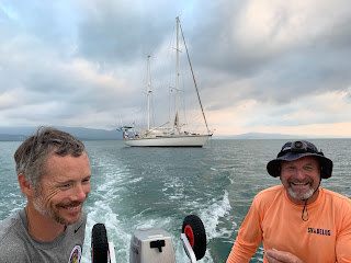
the dinghy into the marsh, which ran parallel to the beach. At high tide, we carefully maneuvered the
dinghy through the deeper sections….and although we didn’t go very far before
it became too shallow, we saw small rays, crabs, and a variety of fish and
birds.
 |
| Fresh sushi! |
 |
| Dinghy ride through the marsh at Bahia Santa Maria |
 |
| Demian finds a path for us to take through the marsh--and swims back to the dinghy |
 |
| Fun adventure through the marsh |
After
leaving this bay, we finally, too, got some real sailing in as we flew the
ballooner most of the day. This was not the first time Kevin and I had flown
this sail—but it is the first time we realized the perfection of down-wind
sailing: we had 15 knots of wind behind us with following seas….we were
cruising along.
______________________________________________________
Tuesday
morning, Nov. 5th, we arrived in Cabo around 8:00 a.m.
Since Cabo
was hosting a fishing tournament when we arrived, we had no luck of securing a
slip in the marina, which meant finding an anchor spot right in front of one of
the huge hotels lining the beach. There were only two other sailboats, a huge
pleasure yacht (complete with an inflatable slide), and two other catamarans. I
expected to see a lot of boats anchored here—until we realized what a rolly
anchorage this was. Even our flopper stopper (a device that helps stabilize the
boat) did not help reduce our rockin’ and rollin’. We actually had huge cruise
ships (yep, the same Disney cruise line that we saw leaving SD) parked behind
us—and these, combined with tons of panga boats and other tourist-types of boats
speeding past us at all hours, made us reconsider staying more than one night.
So we had enjoyed one Cabo restaurant, complete with fish tacos, Tacate beers,
and margaritas, strolled through one small section of town, and we did snorkel
near Anegada Rock, just north of the point, for an hour or two. The water color
was beautiful and there was plenty of fish, but the water was pretty churned up
by all the other snorkelers and divers in the area.
After a
sweaty night being tossed around and smelling burning trash so acutely it would
make an asthmatic hyperventilate (trash burning, we would come to find out, is
quite a common practice in both small and large Mexican towns), the next
morning we hastily got gas and groceries and weighed anchor.
 |
| After several nights at sea, we arrive in Cabo San Lucas around 8:00 a.m. |
 |
| Sleepy-faced but excited to be here! |
 |
| It was pretty hot in Cabo so we jumped in as soon as the anchor was set. The water temp was about 85 degrees! |
 |
| Snorkeling near Anegada Rock at the point. |
 |
| Add caption |
 |
| Here comes the Disney cruiseline--parked behind us for the night. |
_____________________________________________________
Cabo to
Isla Isabel
The two
night passage from Cabo to the remote island called Isla Isabel felt even more
remote and isolated than our journey along the Baja coastline; this was due, in
part, to our exposure to the open ocean—where our track did not run parallel to
any coast line—and the depth of the ocean. Our B&G chart plotter provides
the depth no matter where our boat is located, of course, and on this passage we
were regularly reading “9998” or “10105”—by far the deepest water we had ever
traversed.
Isla Isabel
has been named “the Galapagos of the Mexico” for good reason: it is isolated but
absolutely teeming with life, namely birds and iguanas and an amazing variety
of sea life. Famous for the black and red Frigates and Blue-Footed Boobies,
this island is a National Park and research site for Mexican University
students. We anchored right near the village where the students, who lived in
tents and small huts on the island, and we were the only boat there; the
anchorage (South side, not the East side, where there was only one other boat
anchored) is known for swallowing up boat anchors, so we took care to attach a
trip line to the anchor chain (basically a pennant and rope are attached to the
chain so we can identify where the chain is and allow for easier retrieval),
and the guys dove the anchor to ensure a solid hold.
Near the
small beach village, we found amazing snorkeling! The diversity of fish,
clarity of water, and extremely hot temperatures had us pruning up in the
water…we spent the day swimming around and exploring. We needed this after our
morning hike through an overgrown, guano-packed, and mosquito-infested island exploration.
Our destiny was a crater in the middle of the island that basically was a very
large pond and not worth the hike…..we were all so hot that we conjured up
images of poor Vietnam soldiers, who must have suffered the same humidity,
bugs, and creepy crawly objects under ungroomed trails. It was the hottest walk
any of us had ever endured—and for the life of us, we couldn’t remember why we
wanted to conquer that crater (hint to future cruisers visiting this island:
the walk isn’t worth it. The boobies, frigates, iguanas and more could all been
seen around the perimeter of the island, adjacent to the beautiful white sandy
beaches).
At night,
after a beautiful, fully exposed red horizon sunset to our west, we enjoyed
grilled flank steak (our first carne after so many nights of mahi mahi),
sautéed butternut squash, and an incredible Rhone blend from our hometown of
Paso Robles called Oso Libre Carnal, compliments of Todd. We played
Rummy Cube under a very distinctly outlined Milky Way and more stars than I
ever seen; the lack of ambient light here would be reason enough to visit this
incredible island.
 |
| Well, hello! Incredibly tame birds, by the gazillion. |
 |
| Blue-footed boobies |
 |
| Flying Free, at anchor, in the background |
 |
| The tents/huts where the University students stay |
 |
| This guy--with slightly bluer feet--was King! (or Queen :) |
 |
| The huge crater (pond) in the middle of the island. |
______________________________________________________
Isla IsabelàBahia de Matanchen, Mainland Mexico (aka,
the Gold Coast)
If we were
melting at the island, we discovered that it was even hotter in Bahia
Matanchen, near San Blas, one of the oldest towns along the coast in Mexico.
This shallow bay—with not one other boat at anchor—afforded a calm but sweaty
night. We ate at one of the palapa restaurants where I mistook “poco” for “coco”—so
Demian enjoyed fresh coconut juice at room temperature. Haha! Actually, the food
was excellent despite the pesky and persistent mosquitos gnawing away at our
ankles during our meal.
The very
historic town of San Blas, which boasted a mustard yellow cathedral and a famous
fort that we didn’t visit, was only about 5 miles away….note to fellow cruisers:
you can’t walk there as the roads are quite narrow (no shoulders), so be sure
to grab a taxi (not sure if Uber would be available) if you are anchored in
Matanchen. We did stop to witness one crocodile behind a gated fence (the taxi
driver stopped here for us), but we decided not to do the jungle tour as we had
enough bites covering our bodies to resemble the star-studded sky at Isla
Isabel. 😊
 |
| At anchor in Bahia de Matanchen |
 |
| Demian enjoys a warm coconut. Lol! |
 |
| After leaving the San Blas area, these *huge* dolphins joined us. The biggest dolphins we have ever seen--at least 6.5 to 7 feet long. |
The next day
we took off and made our way to Playa Ayala located in Bahia Jaltemba, but the
anchorage became so rolly, we had to leave at 9:00 p.m. (the wind/swell was
forecasted to decrease at 8:00 p.m., but no such luck!). The swell had picked
up enough that we had an uncomfortable ride on the 4 hour trek to Punta Mita—and
we were rounding the tip into Banderas Bay at night. We anchored at Punta Mita,
a relatively wide-open area, around midnight.
______________________________________________________
La Cruz
& we say goodbye to our amazing crew!
It is only a
few miles from Punta Mita to La Cruz in Banderas Bay. Once we arrived at the La
Cruz anchorage, we set off to explore a little of the town, which boasted a well-maintained
plaza surrounded by huge trees (I still need to research the type of trees
these were) and a few choice restaurants. We especially enjoyed Playa Ballena,
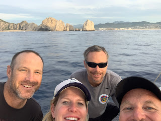
a favorite of cruisers. We took our last snapshots with the guys before they
headed home.
 |
| One of the huge trees in the main plaza at La Cruz |


No comments:
Post a Comment